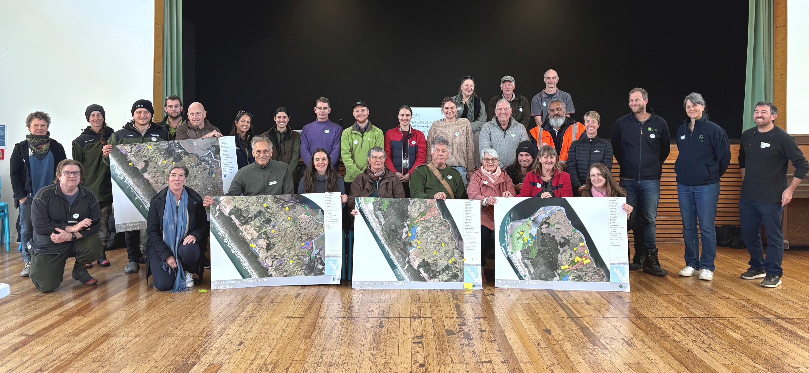
More than 30 people came together at the Helensville War Memorial Hall last month to chart a future for predator control and species protection on Te Korowai-o-te-Tonga/South Head Peninsula.
Hosted by The Forest Bridge Trust (TFBT), the GAP Analysis workshop placed giant maps of the peninsula at the centre of the room. Iwi, landowners, South Kaipara Landcare, Rewild the West, Nga Maunga Whakahii o Kaipara, Auckland Council regional park rangers, the Department of Conservation, and threatened species experts gathered to mark traplines, predator hotspots, and taonga species sightings.
The result is a shared knowledge base that is now being transformed into digital GIS mapping layers to guide a long-term conservation strategy.
“Our role is not to reinvent the wheel,” says Project Manager Helen Jamieson, who facilitated the workshop, “but to strengthen and connect the incredible work already happening on South Head. The enthusiasm and collaboration we saw in that room was inspiring.”
Protecting precious taonga
South Head is home to some of Aotearoa’s most threatened native birds. The tara iti/fairy tern, our rarest breeding bird with fewer than 40 individuals left, nests at Papakanui Spit at the peninsula’s tip. The matuku-hurepo/Australasian bittern, a critically endangered wetland bird known for its booming call, still clings to survival here. And the pateke/brown teal, once widespread, remains nationally threatened but may recover in South Head’s dune lakes and estuaries.
Building on strong foundations
The two-year DOC Community Fund project throws some additional support behind an already active project. TFBT aims to unite these community efforts into a coordinated predator control network. The peninsula has been divided into two zones:
- Northern “tip” (8,500 hectares): intensive predator control to support existing DOC, Ngahere forestry, and community traplines.
- Southern “buffer” (16,700 hectares): strengthening and expanding community-led predator control efforts.
TFBT will bring its expertise in GIS mapping, digital tools, and predator control to complement community knowledge. Predator Control Team member Cam Rathe is coordinating deployment of remotely monitored traps, mobile arrays, and trail cameras to help build a connected predator-free landscape.
Community learning in action
The first event following the GAP Analysis was a matuku-hurepo workshop at Waioneke School, featuring guest speakers Wendy Ambury (Love Bittern) and Boyd Steel (Project 700). Locals learned more about the ecology of this elusive bird and what can be done to protect it.
Looking forward
With the GAP Analysis complete, The Forest Bridge Trust will compile and share a strategic conservation plan through our newly appointed South Head Community Liaison, Heather Steadman. This plan will guide work during the DOC-funded project and provide a framework the community can continue to grow long into the future.
“This project reflects our long-term vision,” says the TFBT team. “It’s about native species thriving across Rodney, with engaged communities and connected habitats.”
The Forest Bridge Trust acknowledges the work undertaken by Nga Maunga Whakahii, South Kaipara Landcare, Auckland Council and Department of Conservation, whose funding is enabling this critical work on South Head to take flight.
The forest bridge trust GAP Analysis
